
bopen / elevation
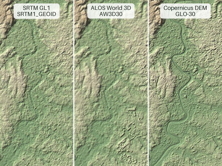
Download, cache and clip global terrain digital elevation models: Mapzen terrain tiles, Copernicus DEM, ALOS World 3D, GEDTM30 and SRTM 30m and 90m DEMs.
Why this job: works in the areas we cover, but does not say which job it does
What it does
Elevation provides easy download, cache and access of the global datasets:
Get started
$ pip install elevation- Maintenance
- Active
- Last commit 3 days ago
- Stars
- 356
- On GitHub
- Licence
- Apache-2.0
- Allows business use
- Downloads for
- None listed
- No release files
- Latest version
- v2.1.0
- Released 3 days ago
- Built with
- Python
- 99% of the code
Is it looked after?
- Contributors
- Not stated
- Last 90 days
- Issues
- 86% closed
- 8 still open
- Pull requests
- 35 merged
- 0 waiting
- Releases
- 4
- 4 in the last year
- Contributing guide (opens in new tab)
- No security policy
- No code of conduct
Similar repos
| Repo | Stars | Last commit | Licence | Downloads for |
|---|---|---|---|---|
| OSGeo / grass | 1,186 | yesterday | Custom | No downloads |
| remotesensinginfo / rsgislib | 177 | 4 months ago | GPL-3.0 | No downloads |
| google-deepmind / forest_typology | 120 | 10 months ago | Apache-2.0 | No downloads |
More: languages, topics and project record
Languages
- Python 99%
- Makefile 1%
Topics
- srtm
- digital-elevation-model
- dem
- mapzen
- copernicus-dem
- earth-observation
- geospatial
- gis
- machine-learning
- remote-sensing
Project record
- JobOther AI tools
- StatusListed
- Commits538
- Forks77
- Watching15
- Stars in 28 days+26
- CreatedMar 17, 2016
- First seen by usNov 7, 2026
- CheckedNov 10, 2026