
ESA-PhiLab / iris
Semi-automatic tool for manual segmentation of multi-spectral and geo-spatial imagery.
Why this job: matched by what the repo talks about: multi, tool, spatial, segmentation
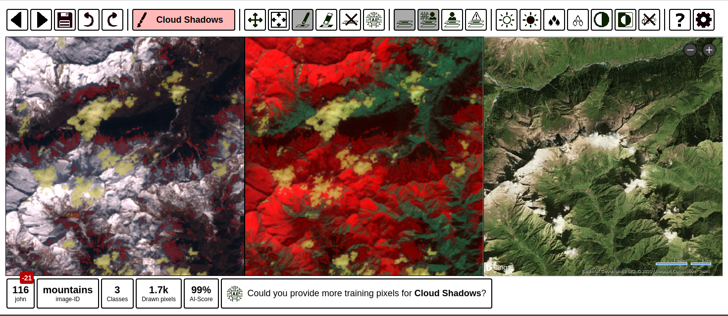
What it does
Tool for manual image segmentation of satellite imagery (or images in general). It was designed to accelerate the creation of machine learning training datasets for Earth Observation. This application is a flask app which can be run locally. Special highlights:
Get started
No single install command. Read the steps in the README (opens in new tab)
- Maintenance
- Inactive
- Last commit 9 months ago
- Stars
- 170
- On GitHub
- Licence
- GPL-3.0
- Share-alike terms
- Downloads for
- None listed
- No release files
- Latest version
- None yet
- No releases
- Built with
- JavaScript
- 38% of the code
Is it looked after?
- Contributors
- Not stated
- Last 90 days
- Issues
- 52% closed
- 15 still open
- Pull requests
- 26 merged
- 2 waiting
- Releases
- None
- Never published
- No contributing guide
- No security policy
- No code of conduct
Similar repos
| Repo | Stars | Last commit | Licence | Downloads for |
|---|---|---|---|---|
| IntelliSensing / RS-Agent | 141 | 2 months ago | Apache-2.0 | No downloads |
More: languages, topics and project record
Languages
- JavaScript 38%
- Python 28%
- HTML 27%
- CSS 7%
Topics
- annotation-tool
- deep-learning
- earth-observation
- human-in-the-loop
- image
- image-labelling-tool
- machine-learning
- python
- remote-sensing
- satellite-imagery
- segmentation
Project record
- JobAgent frameworks
- StatusListed
- Commits291
- Forks46
- Watching9
- Stars in 28 days0
- CreatedJan 20, 2020
- First seen by usNov 7, 2026
- CheckedNov 8, 2026